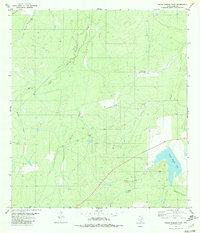
1980 Map of Piedra Parada Tank
USGS Topo · Published 1980About this map
Piedra Parada Tank and its associated Piedra Parada Creek anchor this arid Webb County landscape, where water management is central to the land's utility. The drainage network is dense, defined by the winding paths of Salado Creek, Becerra Creek, and Melone Creek. These seasonal waterways are supplemented by numerous smaller water catchments simply labeled Tank, reflecting the ranching requirements of South Texas.
Find a feature on this map
13 named features on this map. Tap any name to fly to it.
Don’t see what you’re looking for? This feature index may not catch every label — zoom into the map to look around manually.
Map Details
Editions of this 1980 Piedra Parada Tank Map
This is the sole edition of this map. No revisions or reprints were ever made.
Other maps of this area

1937 · Aguilete Creek
USGS Topo · 1:62,500

1956 · Becerra
USGS Topo · 1:62,500

1956 · Laredo East
USGS Topo · 1:62,500

1956 · Webb
USGS Topo · 1:62,500

1956 · Laredo
USGS Topo · 1:250,000

1965 · Cibolo Ranch
USGS Topo · 1:24,000

1965 · Tios Creek
USGS Topo · 1:24,000
1980 · Alamito Creek
USGS Topo · 1:24,000
1980 · Callaghan Ranch SE
USGS Topo · 1:24,000
1980 · Burrito Tank
USGS Topo · 1:24,000
Featured Places
- Village East Colonia, TX
- Las Pilas Colonia Number 2, TX
- Colorado Acres Colonia, TX
- Ranchitos las Lomas Number 2 Colonia, TX
- Hillside Acres Number 1 Colonia, TX