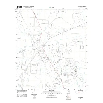
2012 Map of Callahan
USGS Topo · Published 2012About this map
Nassau Village and the rural crossroads of Ratliff anchor this portion of Nassau County, characterized by a dense network of creek drainages and localized agriculture. The northern reach is defined by the Dundee Willows Poultry Farm near the settlement of Dyal, while the central landscape is carved by the winding paths of Alligator Cr, Cushing Cr, and Funks Cr. This modern survey illustrates a transition from larger undeveloped tracts toward expanding residential road networks, particularly east of the Braddock Cr basin. Many roads, such as Mount Olive Rd and Live Oak Church Rd, suggest the locations of early community landmarks and family holdings that have shaped the local geography. To the south, Thomas Cr forms a significant hydrological boundary, with the surrounding terrain showing the characteristic low-lying drainage patterns typical of the region's coastal plains.
Find a feature on this map
174 named features on this map. Tap any name to fly to it.
Don’t see what you’re looking for? This feature index may not catch every label — zoom into the map to look around manually.
Map Details
Editions of this 2012 Callahan Map
This is the sole edition of this map. No revisions or reprints were ever made.
Other maps of this area

1917 · Cambon
USGS Topo · 1:62,500

1917 · Hilliard
USGS Topo · 1:62,500

1918 · St Marys
USGS Topo · 1:62,500

1918 · Cambon
USGS Topo · 1:62,500

1918 · Jacksonville
USGS Topo · 1:62,500

1919 · St Marys
USGS Topo · 1:62,500

1919 · Hilliard
USGS Topo · 1:62,500

1948 · Jacksonville
USGS Topo · 1:250,000

1950 · Trout River
USGS Topo · 1:24,000

1957 · Jacksonville
USGS Topo · 1:250,000