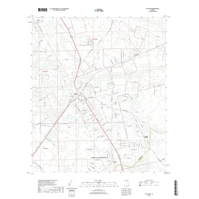
2018 Map of Callahan
USGS Topo · Published 2018About this map
Callahan serves as the central hub of this northern Florida landscape, situated where major roadways and rail lines converge. The area is defined by a dense network of tributaries, including Alligator Cr, Mills Cr, and Thomas Cr, which wind through the low-lying terrain. To the north, the small settlement of Dyal is reached via Dyal Rd, while the southern portion of the map transitions into the residential clusters of Nassau Village-Ratliff and Ratliff.
Find a feature on this map
137 named features on this map. Tap any name to fly to it.
Don’t see what you’re looking for? This feature index may not catch every label — zoom into the map to look around manually.
Map Details
Editions of this 2018 Callahan Map
This is the sole edition of this map. No revisions or reprints were ever made.
Other maps of this area

1917 · Cambon
USGS Topo · 1:62,500

1917 · Hilliard
USGS Topo · 1:62,500

1918 · St Marys
USGS Topo · 1:62,500

1918 · Cambon
USGS Topo · 1:62,500

1918 · Jacksonville
USGS Topo · 1:62,500

1919 · St Marys
USGS Topo · 1:62,500

1919 · Hilliard
USGS Topo · 1:62,500

1948 · Jacksonville
USGS Topo · 1:250,000

1950 · Trout River
USGS Topo · 1:24,000

1957 · Jacksonville
USGS Topo · 1:250,000