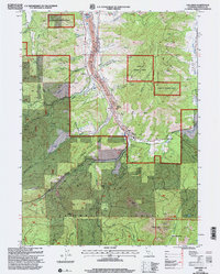
2001 Map of Callahan
USGS Topo · Published 2004About this map
Callahan serves as the focal point of this Siskiyou County survey, situated at the convergence of the South Fork Scott River and the East Fork Scott River. The landscape is defined by the steep elevation changes of the Klamath National Forest and the Trinity Alps Wilderness, reaching peaks like Craggy Peak and Sugar Hill. Extensive evidence of the region's hydraulic and hard-rock mining history is visible along Scott Valley, where numerous tailings deposits and the McKeen Mine are documented.
Find a feature on this map
52 named features on this map. Tap any name to fly to it.
Don’t see what you’re looking for? This feature index may not catch every label — zoom into the map to look around manually.
Map Details
Editions of this 2001 Callahan Map
2 editions found
Other maps of this area

1886 · Shasta
USGS Topo · 1:250,000

1894 · Shasta
USGS Topo · 1:250,000

1923 · Sawyers Bar
USGS Topo · 1:125,000

1931 · Etna
USGS Topo · 1:96,000

1934 · Etna
USGS Topo · 1:125,000

1948 · Weed
USGS Topo · 1:250,000

1950 · Weed
USGS Topo · 1:250,000
1955 · Bonanza King
USGS Topo · 1:62,500
1955 · China Mountain
USGS Topo · 1:62,500

1955 · Etna
USGS Topo · 1:62,500