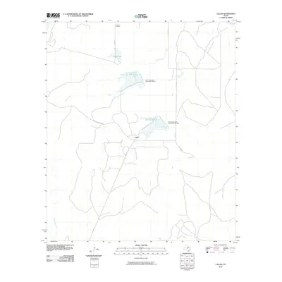
2010 Map of Callan
USGS Topo · Published 2010About this map
Callan sits at the heart of this Menard County landscape, a central point in a region defined by its critical water management infrastructure. The presence of the Soil Conservation Service Site 18a Reservoir and Soil Conservation Service Site 19 Reservoir, along with their respective dams, illustrates a managed rural environment designed to harness the ephemeral flows of West Texas. To the north, the Loveless Cemetery serves as a quiet genealogical marker near the headwaters of Reubes Creek, while Lockett Lake provides another significant water source in this dry terrain.
Find a feature on this map
18 named features on this map. Tap any name to fly to it.
Don’t see what you’re looking for? This feature index may not catch every label — zoom into the map to look around manually.
Map Details
Editions of this 2010 Callan Map
This is the sole edition of this map. No revisions or reprints were ever made.
Other maps of this area

1892 · Eden
USGS Topo · 1:125,000

1896 · Eden
USGS Topo · 1:125,000

1954 · Brownwood
USGS Topo · 1:250,000

1954 · Llano
USGS Topo · 1:250,000

1955 · Llano
USGS Topo · 1:250,000

1956 · Llano
USGS Topo · 1:250,000

1960 · Melvin
USGS Topo · 1:24,000

1970 · Callan
USGS Topo · 1:24,000
1970 · Needle Creek
USGS Topo · 1:24,000
1970 · Eden
USGS Topo · 1:24,000