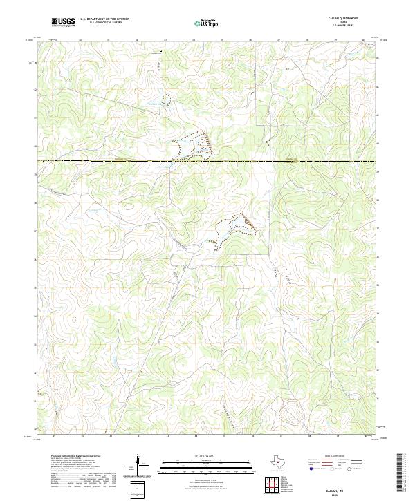
2022 Map of Callan
USGS Topo · Published 2022About this map
The Loveless Cem sits in the northern reaches of this ranching landscape, a primary point of interest for genealogists tracking family history along the Concho and Menard county line. This interior Texas territory is defined by its drainage systems, where seasonal watercourses like Reubes Cr and Fountain Cr carve through the plateau. Small-scale impoundments such as Lockett Lake dot the terrain, reflecting the region's reliance on managed water for livestock and land use. Local connectivity is maintained through a network of rural routes, including Callan Number One Rd and Kitchens Rd, which weave around prominent physical landmarks like Chapman Draw. The map documents a sparsely populated but active agricultural landscape where name-bearing roads and isolated creek beds mark the progress of modern landownership.
Find a feature on this map
17 named features on this map. Tap any name to fly to it.
Don’t see what you’re looking for? This feature index may not catch every label — zoom into the map to look around manually.
Map Details
Editions of this 2022 Callan Map
This is the sole edition of this map. No revisions or reprints were ever made.
Other maps of this area

1892 · Eden
USGS Topo · 1:125,000

1896 · Eden
USGS Topo · 1:125,000

1954 · Brownwood
USGS Topo · 1:250,000

1954 · Llano
USGS Topo · 1:250,000

1955 · Llano
USGS Topo · 1:250,000

1956 · Llano
USGS Topo · 1:250,000

1960 · Melvin
USGS Topo · 1:24,000

1970 · Callan
USGS Topo · 1:24,000
1970 · Needle Creek
USGS Topo · 1:24,000
1970 · Eden
USGS Topo · 1:24,000