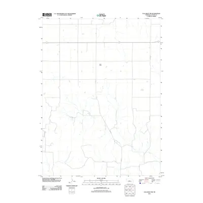
2011 Map of Callaway NW
USGS Topo · Published 2011About this map
West Table dominates the upper central landscape of this rural Custer County quadrangle, situated within a vast network of section-line roads and drainage patterns typical of central Nebraska. The terrain is defined by the winding course of Spring Creek, which meanders through the southern half of the map, carving a path between significant local thoroughfares. Local travel and access are facilitated by a grid of numbered and named roads, including Callaway Rd and Anselmo Rd, which provide a clear picture of the area's rural infrastructure. In the southwest, the topography grows more complex near Pine Canyon Rd, reflecting the varied elevation changes that characterize the transition from flat tablelands to the creek valleys below. This survey captures a specific moment in the early 21st century, illustrating how long-established property boundaries and drainage systems continue to shape the regional landscape.
Find a feature on this map
9 named features on this map. Tap any name to fly to it.
Don’t see what you’re looking for? This feature index may not catch every label — zoom into the map to look around manually.
Map Details
Editions of this 2011 Callaway NW Map
This is the sole edition of this map. No revisions or reprints were ever made.
Other maps of this area

1948 · Linscott
USGS Topo · 1:62,500

1950 · Linscott
USGS Topo · 1:62,500

1951 · Callaway NW
USGS Topo · 1:24,000

1951 · Anselmo
USGS Topo · 1:24,000

1951 · Merna
USGS Topo · 1:24,000

1951 · Anselmo SW
USGS Topo · 1:24,000

1951 · Callaway SE
USGS Topo · 1:24,000

1951 · Callaway
USGS Topo · 1:24,000

1954 · North Platte
USGS Topo · 1:250,000

1955 · Broken Bow
USGS Topo · 1:250,000