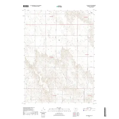
2017 Map of Callaway NW
USGS Topo · Published 2017About this map
West Table dominates the central landscape of this Custer County interior, characterized by the distinctive tableland topography typical of central Nebraska. This 2017 survey by the U.S. Geological Survey illustrates a highly structured grid of section lines and rural routes, such as Cliff Table Rd and Callaway Anselmo Rd, which navigate the elevation shifts between the flat tables and the dissected drainage basins. In the northeast, Ortello Valley provides a notable break in the terrain, while the winding course of Spring Cr carves through the southern sections. The map serves as a precise record of modern land divisions, showing how established ranch roads like River Rd and Spring Creek Rd follow the natural contours of the valley floors to connect isolated homesteads and agricultural operations.
Find a feature on this map
33 named features on this map. Tap any name to fly to it.
Don’t see what you’re looking for? This feature index may not catch every label — zoom into the map to look around manually.
Map Details
Editions of this 2017 Callaway NW Map
This is the sole edition of this map. No revisions or reprints were ever made.
Other maps of this area

1948 · Linscott
USGS Topo · 1:62,500

1950 · Linscott
USGS Topo · 1:62,500

1951 · Callaway NW
USGS Topo · 1:24,000

1951 · Anselmo
USGS Topo · 1:24,000

1951 · Merna
USGS Topo · 1:24,000

1951 · Anselmo SW
USGS Topo · 1:24,000

1951 · Callaway SE
USGS Topo · 1:24,000

1951 · Callaway
USGS Topo · 1:24,000

1954 · North Platte
USGS Topo · 1:250,000

1955 · Broken Bow
USGS Topo · 1:250,000