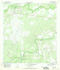
1967 Map of Calliham
USGS Topo · Published 1970About this map
The Frio River and Nueces River converge in this South Texas landscape, defining a region where river-bottom ranching meets the industrial footprint of the mid-century energy boom. The map highlights the McMullen Co Live Oak Co line, which cuts through a terrain marked by the Ezzel Ranch Oil Field and the Frio River Gas Field. This 1967 survey reveals an era of transition, where established rural communities like Calliham and Simmons are interconnected by a growing network of pipelines and specialized infrastructure such as the Launch Field and a remote Landing Strip. Local landmarks like a Cem near the Nueces and several Gravel Pits suggest a landscape of both deep family roots and active resource extraction. The presence of a Gaging Sta and numerous named drainages like Opossum Creek and White Creek underscores the importance of water management in this arid cattle and oil country.
Find a feature on this map
27 named features on this map. Tap any name to fly to it.
Don’t see what you’re looking for? This feature index may not catch every label — zoom into the map to look around manually.
Map Details
Editions of this 1967 Calliham Map
2 editions found
Other maps of this area

1920 · Mikeska
USGS Topo · 1:125,000

1925 · Simmons No. 1
USGS Topo · 1:48,000

1925 · Crowther No. 3
USGS Topo · 1:48,000

1925 · Simmons No. 2
USGS Topo · 1:48,000

1927 · Oakville
USGS Topo · 1:62,500

1929 · Simmons
USGS Topo · 1:62,500

1930 · Whitsett
USGS Topo · 1:62,500

1942 · Whitsett
USGS Topo · 1:62,500

1953 · Crystal City
USGS Topo · 1:250,000

1955 · Crystal City
USGS Topo · 1:250,000