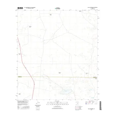
2016 Map of Callo Padrones
USGS Topo · Published 2016About this map
Callo Padrones sits at the heart of this South Texas landscape, where the boundary between Brooks and Hidalgo Counties bisects a region defined by large ranching tracts and ephemeral water bodies. The terrain is organized into distinct named partitions reflecting long-standing land use patterns, such as Padrones Pasture, Julian Pasture, and Magueilles Pasture. These divisions, along with features like El Aceitero Trap and Huisaches Trap, indicate a systematic approach to livestock management in this semi-arid environment. Infrastructure is sparse, primarily consisting of the north-south corridor of Route 281, which provides the main artery through the otherwise open country. Scattered across the brushland are vital water sources like El Callo and Laguna Del Toro Prieto, which serve as landmarks in a territory where the name of a pasture or a specific trap provides the primary geographic orientation for local ranching operations.
Find a feature on this map
13 named features on this map. Tap any name to fly to it.
Don’t see what you’re looking for? This feature index may not catch every label — zoom into the map to look around manually.
Map Details
Editions of this 2016 Callo Padrones Map
This is the sole edition of this map. No revisions or reprints were ever made.
Other maps of this area

1922 · La Sal Vieja
USGS Topo · 1:62,500

1923 · Armstrong
USGS Topo · 1:62,500

1939 · Linn
USGS Topo · 1:62,500

1949 · Mc Allen
USGS Topo · 1:250,000

1953 · Brownsville
USGS Topo · 1:250,000

1954 · McAllen
USGS Topo · 1:250,000

1956 · Pita Camp
USGS Topo · 1:24,000

1956 · Julian
USGS Topo · 1:24,000

1956 · Andrea Ranch
USGS Topo · 1:24,000

1956 · La Sal Vieja
USGS Topo · 1:62,500