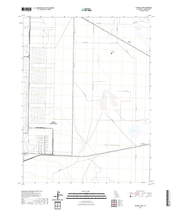
2021 Map of Calneva Lake
USGS Topo · Published 2021About this map
Honey Lake Valley provides the setting for this high-desert landscape in eastern Lassen County, where the transition between arid plains and rugged mountain slopes is clearly defined by drainage patterns and land division. Skedaddle Creek winds through the northern portion of the quadrangle, passing near the settlement of Stacy and the Honey Lake Cem. The map illustrates a strict rectangular grid of the Public Land Survey System, which dictates the placement of local thoroughfares like McClellen Rd and Turtle Mountain Rd. Toward the southeast, the namesake Calneva Lake and the small community of Calneva sit near the California-Nevada border. This modern survey is a valuable resource for tracing property boundaries and identifying isolated landmarks such as Duck Lake Rd and Magazine Rd in a region characterized by its expansive valley floor.
Find a feature on this map
25 named features on this map. Tap any name to fly to it.
Don’t see what you’re looking for? This feature index may not catch every label — zoom into the map to look around manually.
Map Details
Editions of this 2021 Calneva Lake Map
This is the sole edition of this map. No revisions or reprints were ever made.
Other maps of this area

1886 · Honey Lake
USGS Topo · 1:250,000

1886 · Granite Range
USGS Topo · 1:250,000

1891 · Honey Lake
USGS Topo · 1:250,000

1893 · Honey Lake
USGS Topo · 1:250,000

1894 · Granite Range
USGS Topo · 1:250,000

1954 · Wendel
USGS Topo · 1:62,500

1954 · Doyle
USGS Topo · 1:62,500

1955 · Westwood
USGS Topo · 1:250,000

1955 · Lovelock
USGS Topo · 1:250,000

1958 · Westwood
USGS Topo · 1:250,000