
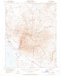
1954 Map of Wendel
USGS Topo · Published 1955About this map
The Sierra Ordnance Depot dominates the southern landscape of this mid-century survey, its expansive grid of bunkers and a dedicated Flight Strip contrasting with the arid terrain of the Honey Lake Valley. Along the northeastern shore of Honey Lake, the settlement of Amedee and its nearby Amedee Hot Springs reflect the region's geothermal activity, while the Pearson Massacre (Site) marks a somber point of local history just to the north. Transport is defined by the Southern Pacific Railroad as it skirts the mountains to serve the rail hub at Wendel. Historically significant routes like the Old Humboldt Road and Idaho Road cut through the high desert of Bull Flat, tracing the path of early emigrant travel through Lassen County. Between the Skedaddle Mountains and Amedee Mountains, numerous springs and small reservoirs like Horsecamp Reservoir reveal the vital water management required for ranching at Skedaddle Ranch.
Find a feature on this map
59 named features on this map. Tap any name to fly to it.
Don’t see what you’re looking for? This feature index may not catch every label — zoom into the map to look around manually.
Map Details
Editions of this 1954 Wendel Map
2 editions found
Other maps of this area

1886 · Honey Lake
USGS Topo · 1:250,000

1886 · Granite Range
USGS Topo · 1:250,000

1891 · Honey Lake
USGS Topo · 1:250,000

1893 · Honey Lake
USGS Topo · 1:250,000

1894 · Granite Range
USGS Topo · 1:250,000

1950 · Milford
USGS Topo · 1:62,500

1954 · Litchfield
USGS Topo · 1:62,500

1954 · Karlo
USGS Topo · 1:62,500

1954 · Doyle
USGS Topo · 1:62,500

1954 · Shinn Mountain
USGS Topo · 1:62,500