
1954 Map of Litchfield
USGS Topo · Published 1955About this map
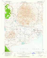
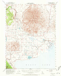
Shaffer Mountain dominates the central landscape of this Lassen County survey, its high slopes overlooking a complex network of water management and transit that defines Honey Lake Valley in the mid-1950s. The Southern Pacific railroad skirts the eastern and western flanks of the mountain, connecting small settlements like Litchfield, Standish, and Buntingville. A rare archaeological detail is noted at the northern base of the mountain with a label for petroglyphs near Belfast. To the south, the hydrologic transition from the Susan River into the Dakin Unit Wildfowl Management Area and the vast expanse of Honey Lake illustrates the region's historical reliance on irrigation and conservation, evidenced by features like the Eagle Lake Ditch and Dutch Ditch.
Find a feature on this map
34 named features on this map. Tap any name to fly to it.
Don’t see what you’re looking for? This feature index may not catch every label — zoom into the map to look around manually.
Map Details
Editions of this 1954 Litchfield Map
3 editions found
Other maps of this area

1886 · Honey Lake
USGS Topo · 1:250,000

1891 · Honey Lake
USGS Topo · 1:250,000

1893 · Honey Lake
USGS Topo · 1:250,000

1950 · Kettle Rock
USGS Topo · 1:62,500

1950 · Milford
USGS Topo · 1:62,500

1954 · Susanville
USGS Topo · 1:62,500

1954 · Wendel
USGS Topo · 1:62,500

1954 · Karlo
USGS Topo · 1:62,500

1954 · Doyle
USGS Topo · 1:62,500

1954 · Fredonyer Peak
USGS Topo · 1:62,500