
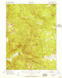
1950 Map of Kettle Rock
USGS Topo · Published 1952About this map
Engel Mine Upper Camp and Lone Pine Mine No 1 sit within the high elevations of the Plumas National Forest, reflecting the mid-century industrial footprint in the Diamond Mts. This 1950 field-checked survey documents a landscape defined by timber and mineral extraction, where a Logging Railroad winds through the eastern terrain near Clover Valley Lumber Camp No 14 and Murdock Crossing. The map captures the remote infrastructure of the era, from the Lights Creek Guard Sta to isolated dwellings like Wemple Cabin and Frazier Cabin. In the southwest, the settlement of Genesee marks the floor of the Genesee Valley, surrounded by notable peaks such as Kettle Rock and Eisenheimer Peak. Drainage patterns are intricately mapped, following Indian Creek and its many tributaries like Last Chance Creek and Red Clover Creek, providing a detailed look at the water sources that sustained these mountain camps and mines.
Find a feature on this map
73 named features on this map. Tap any name to fly to it.
Don’t see what you’re looking for? This feature index may not catch every label — zoom into the map to look around manually.
Map Details
Editions of this 1950 Kettle Rock Map
3 editions found
Other maps of this area

1886 · Honey Lake
USGS Topo · 1:250,000

1890 · Sierraville
USGS Topo · 1:125,000

1891 · Downieville
USGS Topo · 1:125,000

1891 · Honey Lake
USGS Topo · 1:250,000

1892 · Sierraville
USGS Topo · 1:125,000

1893 · Honey Lake
USGS Topo · 1:250,000

1893 · Downieville
USGS Topo · 1:125,000

1894 · Sierraville
USGS Topo · 1:125,000

1895 · Downieville
USGS Topo · 1:125,000

1896 · Downieville
USGS Topo · 1:125,000