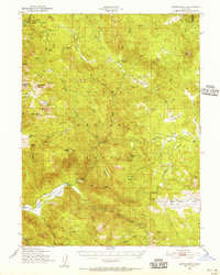
1950 Map of Kettle Rock
USGS Topo · Published 1956About this map
Plumas National Forest and the high peaks of the Diamond Mts define this 1950s landscape, which reveals a remote timber and mining economy. The Poison Railroad and Clover Valley Lumber Camp No 14 highlight mid-century logging operations, while the presence of the Enge Mine, Lucky S Mine No 1, and Beardsley Mine underscores the region's mineral history. Small outposts such as Genesee and the Lights Creek Guard Sta provide evidence of early forest management and scattered settlement. From the heights of Kettle Rock and Wheeler Peak down to Genesee Valley, the terrain is marked by seasonal infrastructure like the Fant Gathering Corral and isolated shelters including Wemple Cabin and Frazier Cabin.
Find a feature on this map
64 named features on this map. Tap any name to fly to it.
Don’t see what you’re looking for? This feature index may not catch every label — zoom into the map to look around manually.
Map Details
Editions of this 1950 Kettle Rock Map
3 editions found

Other maps of this area

1886 · Honey Lake
USGS Topo · 1:250,000

1890 · Sierraville
USGS Topo · 1:125,000

1891 · Downieville
USGS Topo · 1:125,000

1891 · Honey Lake
USGS Topo · 1:250,000

1892 · Sierraville
USGS Topo · 1:125,000

1893 · Honey Lake
USGS Topo · 1:250,000

1893 · Downieville
USGS Topo · 1:125,000

1894 · Sierraville
USGS Topo · 1:125,000

1895 · Downieville
USGS Topo · 1:125,000

1896 · Downieville
USGS Topo · 1:125,000