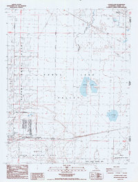
1988 Map of Calneva Lake
USGS Topo · Published 1989About this map
Sierra Army Depot dominates the western portion of this high desert landscape, characterized by its strict Military Reservation Boundary and specialized infrastructure. The map documents a technical and natural transition where the expansive Honey Lake Valley meets the California-Nevada state line. While the depot features industrial elements like storage bins, a heliport, and a rifle range, the eastern half of the quadrangle shifts toward the environmental conservation of the Doyle State Wildlife Area. Hydrological features include the seasonally variable Duck Lake and Calneva Lake, alongside Skedaddle Creek. Evidence of earlier human presence persists at Stacy (Site), while the High Rock Ranch represents continued agricultural activity near the northern boundary.
Find a feature on this map
19 named features on this map. Tap any name to fly to it.
Don’t see what you’re looking for? This feature index may not catch every label — zoom into the map to look around manually.
Map Details
Editions of this 1988 Calneva Lake Map
This is the sole edition of this map. No revisions or reprints were ever made.
Other maps of this area

1886 · Honey Lake
USGS Topo · 1:250,000

1886 · Granite Range
USGS Topo · 1:250,000

1891 · Honey Lake
USGS Topo · 1:250,000

1893 · Honey Lake
USGS Topo · 1:250,000

1894 · Granite Range
USGS Topo · 1:250,000

1954 · Wendel
USGS Topo · 1:62,500

1954 · Doyle
USGS Topo · 1:62,500

1955 · Westwood
USGS Topo · 1:250,000

1955 · Lovelock
USGS Topo · 1:250,000

1958 · Westwood
USGS Topo · 1:250,000