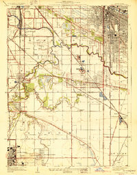
1929 Map of Calumet City
USGS Topo · Published 1929About this map
Little Calumet River meanders across the landscape, shaping the industrial and residential growth of the south Chicago suburbs during the late 1920s. This survey, compiled in part from Air Corps aerial photographs, reveals a region transitioning from rural farmsteads to organized municipalities. The density of transportation infrastructure is striking, with the Pennsylvania Railroad, Illinois Central Railroad, and the storied Lincoln Highway converging to serve centers like Chicago Heights and Calumet City.
Find a feature on this map
61 named features on this map. Tap any name to fly to it.
Don’t see what you’re looking for? This feature index may not catch every label — zoom into the map to look around manually.
Map Details
Editions of this 1929 Calumet City Map
3 editions found
Other maps of this area

1892 · Calumet
USGS Topo · 1:62,500

1893 · Calumet
USGS Topo · 1:62,500

1900 · Toleston
USGS Topo · 1:62,500

1900 · Calumet
USGS Topo · 1:62,500

1901 · Calumet
USGS Topo · 1:62,500

1929 · Calumet Lake
USGS Topo · 1:24,000

1929 · Calumet City
USGS Topo · 1:24,000
1929 · Blue Island
USGS Topo · 1:24,000

1929 · Harvey
USGS Topo · 1:24,000

1929 · Dyer
USGS Topo · 1:24,000