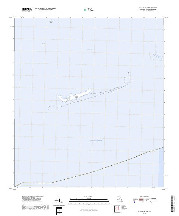
2025 Map of Calumet Island
USGS Topo · Published 2025About this map
Casse-tete Island and Calumet Island sit as isolated landforms within the expanse of Timbalier Bay, illustrating the fragile coastal geography of Lafourche Parish. This 2025 survey documents the shifting barrier island system where East Timbalier Island separates the inland bay waters from the open Gulf of America. The map reveals a landscape defined almost entirely by its relationship with water, where land is a series of fragmented landmasses rather than continuous terrain. This specific representation serves as a contemporary benchmark for coastal change, capturing the current footprint of these islands before further tidal or storm-driven erosion alters their profiles. For those studying Louisiana’s maritime borders, the proximity of these features to the open Gulf provides a clear look at the state's vulnerable southernmost reaches.
Find a feature on this map
5 named features on this map. Tap any name to fly to it.
Don’t see what you’re looking for? This feature index may not catch every label — zoom into the map to look around manually.
Map Details
Editions of this 2025 Calumet Island Map
This is the sole edition of this map. No revisions or reprints were ever made.
Other maps of this area

1892 · Cheniere Caminada
USGS Topo · 1:62,500

1894 · Timbalier
USGS Topo · 1:62,500

1935 · Timbalier Island
USGS Topo · 1:31,680

1935 · Pelican Pass
USGS Topo · 1:31,680

1935 · Calumet Island
USGS Topo · 1:31,680

1935 · Leeville
USGS Topo · 1:31,680

1945 · New Orleans
USGS Topo · 1:250,000

1945 · Leeville
USGS Topo · 1:31,680

1947 · Jacko Bay
USGS Topo · 1:31,680
1949 · Belle Pass
USGS Topo · 1:31,680