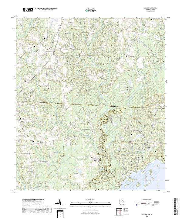
2024 Map of Calvary
USGS Topo · Published 2024About this map
Calvary serves as a central hub in this cross-border region where Grady County, Georgia, meets Gadsden and Leon Counties in Florida. The landscape is defined by the winding course of the Ochlockonee River and its numerous tributaries, including Swamp Creek and Bryants Mill Creek. This modern survey reveals a dense concentration of family and community burial grounds that reflect the deep-rooted genealogical history of the area, ranging from the Williams Cem Old to the Bannerman Plantation Cem near Meridian. The settlement pattern follows a network of rural roads like Higdon Rd and Gainey Rd, which connect scattered homesteads and houses of worship such as the Saint Mary Missionary Baptist Church Cem. Near the southern edge, the terrain transitions into the wetlands surrounding Lake Iamonia, illustrating the complex hydrology of the Georgia-Florida line.
Find a feature on this map
109 named features on this map. Tap any name to fly to it.
Don’t see what you’re looking for? This feature index may not catch every label — zoom into the map to look around manually.
Map Details
Editions of this 2024 Calvary Map
This is the sole edition of this map. No revisions or reprints were ever made.
Other maps of this area

1954 · Tallahassee
USGS Topo · 1:250,000

1955 · Whigham
USGS Topo · 1:62,500

1956 · Havana North
USGS Topo · 1:24,000

1956 · Cairo
USGS Topo · 1:62,500

1956 · Calvary
USGS Topo · 1:24,000

1957 · Beachton
USGS Topo · 1:24,000

1959 · Tallahassee
USGS Topo · 1:250,000

1960 · Tallahassee
USGS Topo · 1:250,000
1963 · Bradfordville
USGS Topo · 1:24,000

1963 · Lake Jackson
USGS Topo · 1:24,000