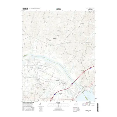
2016 Map of Calvert City
USGS Topo · Published 2016About this map
Calvert City and the neighboring community of Gilbertsville sit at a strategic bend where the Tennessee River flows toward its confluence with the Ohio River Pool. This 2016 survey highlights a landscape defined by water management and transit, featuring the northern reaches of Kentucky Lake and the complex drainage of Cypress Cr and Little Cypress Cr. The area maintains its agricultural and rural character north of the river in settlements like Newbern, where family history is preserved in numerous small burial grounds including Chappell Cem, Wells Cem, and Driskill Cem. Industrial and transport infrastructure is prominent, anchored by the P & L RR corridor and the Kentucky Dam State Park Airport. The map also captures several distinctive natural features like Clear Pond, Open Pond, and the branching waters of Sanders Br Richland Cr, providing a detailed look at the Marshall and Livingston County borderlands in the early 21st century.
Find a feature on this map
121 named features on this map. Tap any name to fly to it.
Don’t see what you’re looking for? This feature index may not catch every label — zoom into the map to look around manually.
Map Details
Editions of this 2016 Calvert City Map
This is the sole edition of this map. No revisions or reprints were ever made.
Other maps of this area

1928 · Eddyville
USGS Topo · 1:48,000

1929 · Smithland
USGS Topo · 1:62,500

1931 · Eddyville
USGS Topo · 1:62,500

1936 · Elva
USGS Topo · 1:24,000

1936 · Eddyville
USGS Topo · 1:48,000

1936 · Grand Rivers
USGS Topo · 1:24,000

1936 · Smithland
USGS Topo · 1:48,000

1936 · Benton
USGS Topo · 1:48,000

1936 · Birmingham
USGS Topo · 1:24,000

1936 · Golden Pond
USGS Topo · 1:48,000