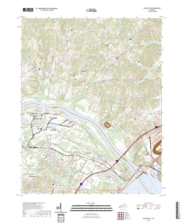
2022 Map of Calvert City
USGS Topo · Published 2022About this map
The Tennessee River winds through the heart of this landscape, separating the communities of Gilbertsville and Calvert City from the rural uplands to the north. This region is defined by its transition from the wide waters of Kentucky Lake and the managed flow below the dam to the intricate network of creeks like Cypress Cr and Hickory Cr. The map reveals a dense distribution of family burial grounds, including the Ramage Cem, Wells Cem, and Driskill Cem, which are invaluable for genealogists tracing local lineage in Marshall and Livingston counties.
Find a feature on this map
131 named features on this map. Tap any name to fly to it.
Don’t see what you’re looking for? This feature index may not catch every label — zoom into the map to look around manually.
Map Details
Editions of this 2022 Calvert City Map
This is the sole edition of this map. No revisions or reprints were ever made.
Other maps of this area

1928 · Eddyville
USGS Topo · 1:48,000

1929 · Smithland
USGS Topo · 1:62,500

1931 · Eddyville
USGS Topo · 1:62,500

1936 · Elva
USGS Topo · 1:24,000

1936 · Eddyville
USGS Topo · 1:48,000

1936 · Grand Rivers
USGS Topo · 1:24,000

1936 · Smithland
USGS Topo · 1:48,000

1936 · Benton
USGS Topo · 1:48,000

1936 · Birmingham
USGS Topo · 1:24,000

1936 · Golden Pond
USGS Topo · 1:48,000