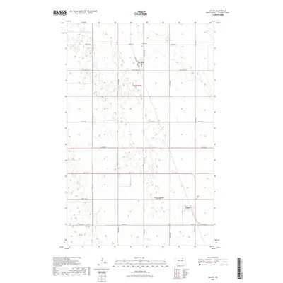
2017 Map of Calvin
USGS Topo · Published 2017About this map
Calvin and Clyde represent the primary nodes of settlement in this part of Cavalier County, positioned within a landscape defined by its rigid section lines and prairie potholes. The town of Calvin is structured around Railroad Ave and 3rd Ave, reflecting an orientation typical of rail-adjacent plains towns. To the north, the Corinthian Cem serves the local community, while further south, the Clyde Cem sits just northwest of the townsite of Clyde. The road network, including arterial routes like 95th St Ne and 80th Ave Ne, forms a precise grid across the townships of t162n r64w and t161n r64w, revealing how agricultural land management has fundamentally shaped the region's geography.
Find a feature on this map
22 named features on this map. Tap any name to fly to it.
Don’t see what you’re looking for? This feature index may not catch every label — zoom into the map to look around manually.
Map Details
Editions of this 2017 Calvin Map
This is the sole edition of this map. No revisions or reprints were ever made.
Other maps of this area

1953 · Devils Lake
USGS Topo · 1:250,000

1956 · Devils Lake
USGS Topo · 1:250,000

1962 · Egeland
USGS Topo · 1:24,000

1969 · Rock Lake NE
USGS Topo · 1:24,000

1970 · Sarles NE
USGS Topo · 1:24,000

1970 · Calvin
USGS Topo · 1:24,000

1970 · Sarles SE
USGS Topo · 1:24,000

1970 · Sarles
USGS Topo · 1:24,000

1970 · Rock Lake SE
USGS Topo · 1:24,000

1970 · Munich
USGS Topo · 1:24,000