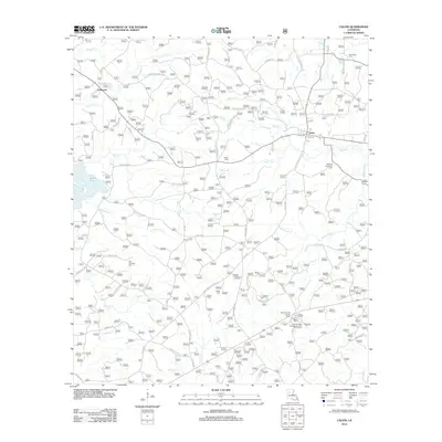
2012 Map of Calvin
USGS Topo · Published 2012About this map
Calvin and Coldwater serve as the primary nodes of settlement in this part of Winn Parish, where the piney woods are dissected by a dense network of small waterways. To the west, the map captures the eastern shore of Saline Lake, while numerous creeks including Hurricane Cr, Mill Cr, and White Oak Cr carve through the landscape. The infrastructure reveals a mix of old parish roads and more modern thoroughfares, with the high ground of the Gum Springs Lookout Tower providing a strategic vantage point over the timberland.
Find a feature on this map
63 named features on this map. Tap any name to fly to it.
Don’t see what you’re looking for? This feature index may not catch every label — zoom into the map to look around manually.
Map Details
Editions of this 2012 Calvin Map
This is the sole edition of this map. No revisions or reprints were ever made.
Other maps of this area

1947 · Goldonna
USGS Topo · 1:62,500

1949 · Calvin SE
USGS Topo · 1:31,680

1949 · Calvin NE
USGS Topo · 1:31,680

1949 · Calvin NW
USGS Topo · 1:31,680

1949 · Calvin SW
USGS Topo · 1:31,680

1949 · Jonesboro
USGS Topo · 1:62,500

1950 · Jonesboro
USGS Topo · 1:62,500

1950 · Winnfield
USGS Topo · 1:62,500

1951 · Winnfield
USGS Topo · 1:62,500

1953 · Alexandria
USGS Topo · 1:250,000