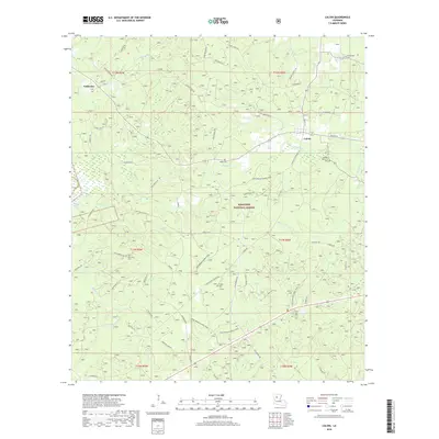
2018 Map of Calvin
USGS Topo · Published 2018About this map
The rolling pine woods of Kisatchie National Forest define this portion of Winn Parish, where the small community of Calvin sits at the intersection of local routes and the Louisiana and Arkansas Railway. The landscape is deeply etched by a network of drainage systems, including Garfish Cr, Kylies Cr, and Couley Cr, which feed into larger basins such as Saline Lake on the western edge. This 2018 survey reveals a terrain crisscrossed by established forestry roads and the winding Gum Springs Horse Trail, reflecting the area's dual character as a timber-producing region and a recreational haven.
Find a feature on this map
63 named features on this map. Tap any name to fly to it.
Don’t see what you’re looking for? This feature index may not catch every label — zoom into the map to look around manually.
Map Details
Editions of this 2018 Calvin Map
This is the sole edition of this map. No revisions or reprints were ever made.
Other maps of this area

1947 · Goldonna
USGS Topo · 1:62,500

1949 · Calvin SE
USGS Topo · 1:31,680

1949 · Calvin NE
USGS Topo · 1:31,680

1949 · Calvin NW
USGS Topo · 1:31,680

1949 · Calvin SW
USGS Topo · 1:31,680

1949 · Jonesboro
USGS Topo · 1:62,500

1950 · Jonesboro
USGS Topo · 1:62,500

1950 · Winnfield
USGS Topo · 1:62,500

1951 · Winnfield
USGS Topo · 1:62,500

1953 · Alexandria
USGS Topo · 1:250,000