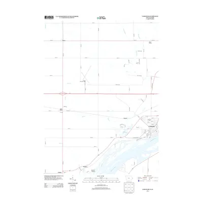
2013 Map of Camanche
USGS Topo · Published 2013About this map
The Mississippi River defines the southeastern border of this landscape, where the town of Camanche sits along the shoreline overlooking a complex network of channels and islands. Moving inland, the terrain transitions into a grid of agricultural land and small settlements, including Low Moor and Elvira to the west and northwest. The presence of Clinton Municipal Airport and the residential expansion near Chaney reflect the 21st-century development pattern of this river valley region. Local landmarks like Andersen Dairy and Devils Hollow provide specific points of interest for genealogists and local historians tracking family sites or rural land use. Water features such as Rock Creek and Sodus Creek wind through the township, while Willow Lake and Nancy Elaine Lake offer insight into the managed water bodies near the river's edge, including the Rock Creek Marina and Campground located south near Shaffton.
Find a feature on this map
89 named features on this map. Tap any name to fly to it.
Don’t see what you’re looking for? This feature index may not catch every label — zoom into the map to look around manually.
Map Details
Editions of this 2013 Camanche Map
This is the sole edition of this map. No revisions or reprints were ever made.
Other maps of this area

1891 · Clinton
USGS Topo · 1:62,500

1892 · Goose Lake
USGS Topo · 1:62,500

1892 · Leclaire
USGS Topo · 1:62,500

1893 · Leclaire
USGS Topo · 1:62,500

1894 · Goose Lake
USGS Topo · 1:62,500

1894 · Clinton
USGS Topo · 1:62,500

1899 · Clinton
USGS Topo · 1:125,000

1952 · Erie
USGS Topo · 1:62,500

1952 · Clinton
USGS Topo · 1:62,500
1952 · Cordova
USGS Topo · 1:24,000