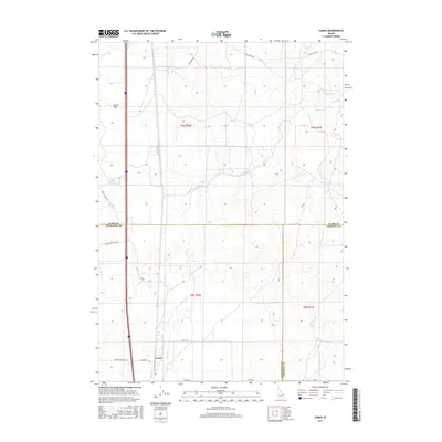
2017 Map of Camas
USGS Topo · Published 2017About this map
Camas stands as the primary settlement within this high-desert landscape, situated at the boundary where the Snake River Plain meets the diverging drainages of the north. The area is defined by its seasonal watercourses, with Beaver Cr and Camas Cr meandering through the terrain, creating localized wetlands amidst the sagebrush and lava-rock plains. The map reveals a highly structured grid of range roads including Laird Rock Rd and Snake River Plain Rd, which serve a network of rural land plots typical of this region's agricultural and ranching heritage.
Find a feature on this map
20 named features on this map. Tap any name to fly to it.
Don’t see what you’re looking for? This feature index may not catch every label — zoom into the map to look around manually.
Map Details
Editions of this 2017 Camas Map
This is the sole edition of this map. No revisions or reprints were ever made.
Other maps of this area

1955 · Dubois
USGS Topo · 1:250,000

1955 · Idaho Falls
USGS Topo · 1:250,000

1958 · Dubois
USGS Topo · 1:250,000

1958 · Idaho Falls
USGS Topo · 1:250,000

1964 · Dubois NW
USGS Topo · 1:24,000

1964 · Lone Butte
USGS Topo · 1:24,000

1964 · Dubois NE
USGS Topo · 1:24,000
1964 · Hamer
USGS Topo · 1:24,000

1964 · Camas
USGS Topo · 1:24,000

1964 · Rays Lake
USGS Topo · 1:24,000