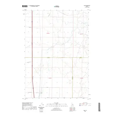
2020 Map of Camas
USGS Topo · Published 2020About this map
Camas sits at the intersection of a vast agricultural and transit network in the high desert of the eastern Snake River Plain. This 2020 map documents a landscape defined by its hydrology and transportation corridors, where Beaver Cr and Camas Cr cut across a grid of section lines and irrigation-adjacent roadways. The terrain is characterized by the wide, level expanse of Dutch Flat and the foundational basalt geology of the Snake River Plain Rd vicinity. Cultural geography is traced through a dense network of local routes like Laird Rock Rd, Lamb Shed Rd, and N Old Butte Hwy, reflecting the area's agricultural heritage and the evolution of Idaho's highway system from the era of Old Hwy 91. The map captures the precise boundaries where Jefferson, Clark, and Fremont counties meet, providing a clear view of the region's rural structure and water management patterns.
Find a feature on this map
21 named features on this map. Tap any name to fly to it.
Don’t see what you’re looking for? This feature index may not catch every label — zoom into the map to look around manually.
Map Details
Editions of this 2020 Camas Map
This is the sole edition of this map. No revisions or reprints were ever made.
Other maps of this area

1955 · Dubois
USGS Topo · 1:250,000

1955 · Idaho Falls
USGS Topo · 1:250,000

1958 · Dubois
USGS Topo · 1:250,000

1958 · Idaho Falls
USGS Topo · 1:250,000

1964 · Dubois NW
USGS Topo · 1:24,000

1964 · Lone Butte
USGS Topo · 1:24,000

1964 · Dubois NE
USGS Topo · 1:24,000
1964 · Hamer
USGS Topo · 1:24,000

1964 · Camas
USGS Topo · 1:24,000

1964 · Rays Lake
USGS Topo · 1:24,000