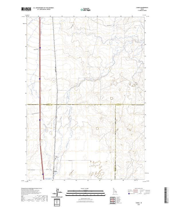
2023 Map of Camas
USGS Topo · Published 2023About this map
Camas anchors this high-desert landscape in southeastern Idaho, where the northern reaches of the Snake River Plain Rd meet the foothills. The settlement’s history is inextricably tied to the water and transport corridor formed by Beaver Creek and Camas Creek, which cut through the level expanse of Dutch Flat. Local family history is centered at the Camas North Cem, located just north of the village. The map captures a vital intersection of jurisdictional boundaries, showing the meeting point of Clark, Jefferson, and Fremont counties. Rural life is traced through a network of functional thoroughfares including Old Hwy 91 and specialized routes like Lamb Shed Rd and Laird Rock Rd, illustrating the area's agricultural and ranching foundations.
Find a feature on this map
22 named features on this map. Tap any name to fly to it.
Don’t see what you’re looking for? This feature index may not catch every label — zoom into the map to look around manually.
Map Details
Editions of this 2023 Camas Map
This is the sole edition of this map. No revisions or reprints were ever made.
Other maps of this area

1955 · Dubois
USGS Topo · 1:250,000

1955 · Idaho Falls
USGS Topo · 1:250,000

1958 · Dubois
USGS Topo · 1:250,000

1958 · Idaho Falls
USGS Topo · 1:250,000

1964 · Dubois NW
USGS Topo · 1:24,000

1964 · Lone Butte
USGS Topo · 1:24,000

1964 · Dubois NE
USGS Topo · 1:24,000
1964 · Hamer
USGS Topo · 1:24,000

1964 · Camas
USGS Topo · 1:24,000

1964 · Rays Lake
USGS Topo · 1:24,000