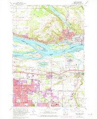
1961 Map of Camas
USGS Topo · Published 1971About this map
The Columbia River serves as the central artery for this industrial and agricultural borderland between Washington and Oregon. On the northern shore, the city of Camas is defined by its proximity to Lacamas Lake and a complex industrial shoreline featuring the Camas Slough and Lady Island. This era captures the town's expansion alongside Washougal, where public spaces like Crown Park and Louis Bloch Park provide community anchors.
Find a feature on this map
89 named features on this map. Tap any name to fly to it.
Don’t see what you’re looking for? This feature index may not catch every label — zoom into the map to look around manually.
Map Details
Editions of this 1961 Camas Map
3 editions found
Other maps of this area

1897 · Portland
USGS Topo · 1:62,500

1905 · Portland
USGS Topo · 1:62,500

1911 · Boring
USGS Topo · 1:48,000

1914 · Boring
USGS Topo · 1:62,500

1914 · Oregon City
USGS Topo · 1:62,500

1916 · Estacada
USGS Topo · 1:125,000

1918 · Troutdale
USGS Topo · 1:62,500

1934 · Troutdale
USGS Topo · 1:48,000

1939 · Oregon City
USGS Topo · 1:62,500

1940 · Boring
USGS Topo · 1:62,500