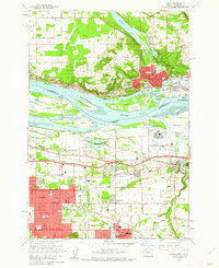
1961 Map of Camas
USGS Topo · Published 1962About this map
The Columbia River forms a wide, complex boundary between Washington and Oregon in this early 1960s survey, anchoring the industrial and residential growth of Camas and Troutdale. On the Washington side, the landscape is defined by Prune Hill and the recreational waters of Lacamas Lake, while the Oregon shore features a dense network of suburban expansion around Rockwood and Gresham. This era shows a community in transition, where the heavy industry of the Aluminum Plant and the Port of Camas-Washougal operates alongside established institutions like the County Farm and Home. Local genealogy and social history are preserved through numerous local landmarks, including the Helen Baller Sch, Fern Prairie Cem, and the distinctive Water Drive-in Theater. Transport infrastructure is prominent, with the Union Pacific RR and Banfield Expressway providing vital links through the river valley.
Find a feature on this map
85 named features on this map. Tap any name to fly to it.
Don’t see what you’re looking for? This feature index may not catch every label — zoom into the map to look around manually.
Map Details
Editions of this 1961 Camas Map
3 editions found
Other maps of this area

1897 · Portland
USGS Topo · 1:62,500

1905 · Portland
USGS Topo · 1:62,500

1911 · Boring
USGS Topo · 1:48,000

1914 · Boring
USGS Topo · 1:62,500

1914 · Oregon City
USGS Topo · 1:62,500

1916 · Estacada
USGS Topo · 1:125,000

1918 · Troutdale
USGS Topo · 1:62,500

1934 · Troutdale
USGS Topo · 1:48,000

1939 · Oregon City
USGS Topo · 1:62,500

1940 · Boring
USGS Topo · 1:62,500