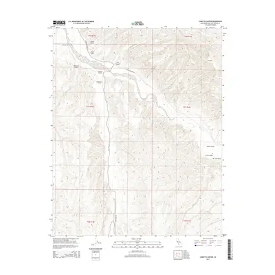
2015 Map of Camatta Canyon
USGS Topo · Published 2015About this map
San Juan Creek carves a winding path through this corner of San Luis Obispo County, defining the agricultural and ranching landscape of the San Juan Valley. The topography is dominated by a complex network of drainage systems, including Camatta Canyon, Gillis Canyon, and the curiously named Tin Pan Canyon. These canyons navigate the high ground of the Red Hills, creating a rugged backdrop for the isolated infrastructure of the region.
Find a feature on this map
23 named features on this map. Tap any name to fly to it.
Don’t see what you’re looking for? This feature index may not catch every label — zoom into the map to look around manually.
Map Details
Editions of this 2015 Camatta Canyon Map
This is the sole edition of this map. No revisions or reprints were ever made.
Other maps of this area

1914 · Cholame
USGS Topo · 1:125,000

1915 · Cholame
USGS Topo · 1:125,000

1917 · Cholame
USGS Topo · 1:125,000

1922 · Pozo
USGS Topo · 1:62,500

1932 · La Panza
USGS Topo · 1:48,000

1935 · La Panza
USGS Topo · 1:62,500

1936 · La Panza
USGS Topo · 1:62,500

1943 · Grant Lake
USGS Topo · 1:31,680

1943 · Shandon
USGS Topo · 1:31,680

1943 · Commatti Canyon
USGS Topo · 1:31,680