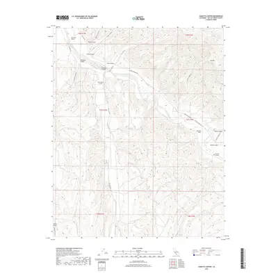
2018 Map of Camatta Canyon
USGS Topo · Published 2018About this map
San Juan Creek meanders through a landscape of deep canyons and seasonal drainage channels in this high-desert region of San Luis Obispo County. The terrain is defined by the broad San Juan Valley and the distinctive Red Hills, which tower over a network of tributary canyons including Camatta Canyon, Tucker Canyon, and Slocum Canyon. This 2018 survey reveals a sparse settlement pattern dominated by large landholdings and private ranching operations, exemplified by the Blech Ranch Airport situated along Shell Creek Rd. The road network follows the natural contours of the land, with routes like Cammatta Shandon Rd connecting the remote interior canyons to the wider valley. Researchers will find a meticulously documented topography of ephemeral watercourses and family-named landmarks that preserve the ranching heritage of the California interior.
Find a feature on this map
29 named features on this map. Tap any name to fly to it.
Don’t see what you’re looking for? This feature index may not catch every label — zoom into the map to look around manually.
Map Details
Editions of this 2018 Camatta Canyon Map
This is the sole edition of this map. No revisions or reprints were ever made.
Other maps of this area

1914 · Cholame
USGS Topo · 1:125,000

1915 · Cholame
USGS Topo · 1:125,000

1917 · Cholame
USGS Topo · 1:125,000

1922 · Pozo
USGS Topo · 1:62,500

1932 · La Panza
USGS Topo · 1:48,000

1935 · La Panza
USGS Topo · 1:62,500

1936 · La Panza
USGS Topo · 1:62,500

1943 · Grant Lake
USGS Topo · 1:31,680

1943 · Shandon
USGS Topo · 1:31,680

1943 · Commatti Canyon
USGS Topo · 1:31,680