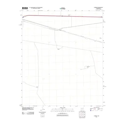
2010 Map of Cambray
USGS Topo · Published 2010About this map
Cambray stands as the primary junction point in this high desert landscape, where transport lines converge in the northern portion of the quadrangle. The settlement pattern is defined by isolated ranching and water infrastructure, essential for survival in this arid environment. Scattered landmarks like Alkali Windmill, Cambray Windmill, and the San Luis Windmill to the southwest indicate the reliance on groundwater for the surrounding rangeland. To the north, Geronimo Ranch sits near the corridor formed by the Frontage Rd and the interstate system. The terrain is largely level, punctuated only by the distinct geological rise of Providence Cone in the eastern section. This 2010 survey illustrates the modernization of historic routes, with County Rd-B008 slicing diagonally across the plains toward the boundary of Doña Ana County.
Find a feature on this map
9 named features on this map. Tap any name to fly to it.
Don’t see what you’re looking for? This feature index may not catch every label — zoom into the map to look around manually.
Map Details
Editions of this 2010 Cambray Map
This is the sole edition of this map. No revisions or reprints were ever made.
Other maps of this area

1941 · Aden
USGS Topo · 1:62,500

1943 · Aden
USGS Topo · 1:62,500

1943 · Corralitos Ranch
USGS Topo · 1:62,500

1955 · Las Cruces
USGS Topo · 1:250,000

1958 · Las Cruces
USGS Topo · 1:250,000

1972 · Myndus
USGS Topo · 1:24,000

1972 · Cambray
USGS Topo · 1:24,000
1972 · X-7 Ranch
USGS Topo · 1:24,000

1972 · Lazy E Ranch
USGS Topo · 1:24,000
1972 · Akela
USGS Topo · 1:24,000