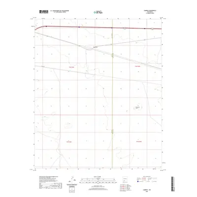
2020 Map of Cambray
USGS Topo · Published 2020About this map
Cambray occupies a central position on this high-desert plateau near the border of Luna and Doña Ana counties. The landscape is defined by its wide, open reaches and utilitarian infrastructure, including the straight courses of Cell Tower Rd and Pipeline Rd. A notable geological landmark, Providence Cone, rises in the southeastern quadrant, breaking the relatively flat terrain of the region. This 2020 record illustrates the enduring isolation of the Chihuahuan Desert landscape, where development is largely restricted to linear utility corridors and small clusters of activity along the established roadway network.
Find a feature on this map
9 named features on this map. Tap any name to fly to it.
Don’t see what you’re looking for? This feature index may not catch every label — zoom into the map to look around manually.
Map Details
Editions of this 2020 Cambray Map
This is the sole edition of this map. No revisions or reprints were ever made.
Other maps of this area

1941 · Aden
USGS Topo · 1:62,500

1943 · Aden
USGS Topo · 1:62,500

1943 · Corralitos Ranch
USGS Topo · 1:62,500

1955 · Las Cruces
USGS Topo · 1:250,000

1958 · Las Cruces
USGS Topo · 1:250,000

1972 · Myndus
USGS Topo · 1:24,000

1972 · Cambray
USGS Topo · 1:24,000
1972 · X-7 Ranch
USGS Topo · 1:24,000

1972 · Lazy E Ranch
USGS Topo · 1:24,000
1972 · Akela
USGS Topo · 1:24,000