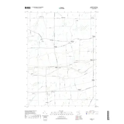
2019 Map of Cambria
USGS Topo · Published 2019About this map
The Niagara County escarpment shapes the geography of this Western New York landscape, where the elevation drops from Upper Mountain Rd toward the orchard and farm lands of the north. Small agricultural hamlets such as North Ridge, Cambria Center, and Molyneaux Corners sit along historic transit corridors like Ridge Rd. The area is notably dense with small family and parish burial grounds, including the Hillside Cem of Cambria and the Weaver Cem Number 1, which speak to the long-established lineage of local farming families. Transport remains central to the region's identity, evidenced by the rail crossing at Lockport Junction and the small-scale aviation at Hibbard's Airport. In the south, the headwaters of Bergholtz Cr and Bull Cr meander through the flats near Shawnee, providing drainage for the fertile plains below the limestone ridge.
Find a feature on this map
73 named features on this map. Tap any name to fly to it.
Don’t see what you’re looking for? This feature index may not catch every label — zoom into the map to look around manually.
Map Details
Editions of this 2019 Cambria Map
This is the sole edition of this map. No revisions or reprints were ever made.
Other maps of this area

1894 · Wilson
USGS Topo · 1:62,500

1897 · Tonawanda
USGS Topo · 1:62,500

1897 · Olcott
USGS Topo · 1:62,500

1897 · Lockport
USGS Topo · 1:62,500

1899 · Niagara
USGS Topo · 1:125,000

1900 · Wilson
USGS Topo · 1:62,500

1900 · Tonawanda
USGS Topo · 1:62,500

1901 · Tonawanda
USGS Topo · 1:62,500

1902 · Lockport
USGS Topo · 1:62,500

1905 · Lockport
USGS Topo · 1:62,500