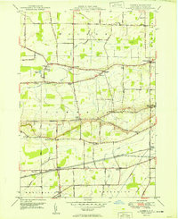
1949 Map of Cambria
USGS Topo · Published 1949About this map
The Niagara Escarpment defines the physical and social geography of this 1949 survey, where the dramatic elevation change separates the lower plains of Wilson and Newfane from the higher ground in Wheatfield and Pendleton. This topographic divide is traversed by a network of early local thoroughfares, including Lower Mountain Road and Upper Mountain Road, which follow the contours of the ridge. The agrarian economy of the mid-20th century is evidenced by the numerous orchards and vineyards dotting the landscape near settlements like North Ridge and Warrens Corners.
Find a feature on this map
61 named features on this map. Tap any name to fly to it.
Don’t see what you’re looking for? This feature index may not catch every label — zoom into the map to look around manually.
Map Details
Editions of this 1949 Cambria Map
This is the sole edition of this map. No revisions or reprints were ever made.
Other maps of this area

1894 · Wilson
USGS Topo · 1:62,500

1897 · Tonawanda
USGS Topo · 1:62,500

1897 · Olcott
USGS Topo · 1:62,500

1897 · Lockport
USGS Topo · 1:62,500

1899 · Niagara
USGS Topo · 1:125,000

1900 · Wilson
USGS Topo · 1:62,500

1900 · Tonawanda
USGS Topo · 1:62,500

1901 · Tonawanda
USGS Topo · 1:62,500

1902 · Lockport
USGS Topo · 1:62,500

1905 · Lockport
USGS Topo · 1:62,500