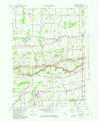
1980 Map of Cambria
USGS Topo · Published 1980About this map
Lockport Air Force Station and the sprawling campus of Niagara County Community College anchor the southern landscape of this Niagara County region. The terrain is defined by the distinct escarpment running east-west, where Lower Mountain Road and Upper Mountain Road trace the elevation change. This transition between the lake plain and the higher ground to the south is dotted with established crossroads such as North Ridge, Molyneaux Corners, and Cambria Center.
Find a feature on this map
56 named features on this map. Tap any name to fly to it.
Don’t see what you’re looking for? This feature index may not catch every label — zoom into the map to look around manually.
Map Details
Editions of this 1980 Cambria Map
This is the sole edition of this map. No revisions or reprints were ever made.
Other maps of this area

1894 · Wilson
USGS Topo · 1:62,500

1897 · Tonawanda
USGS Topo · 1:62,500

1897 · Olcott
USGS Topo · 1:62,500

1897 · Lockport
USGS Topo · 1:62,500

1899 · Niagara
USGS Topo · 1:125,000

1900 · Wilson
USGS Topo · 1:62,500

1900 · Tonawanda
USGS Topo · 1:62,500

1901 · Tonawanda
USGS Topo · 1:62,500

1902 · Lockport
USGS Topo · 1:62,500

1905 · Lockport
USGS Topo · 1:62,500