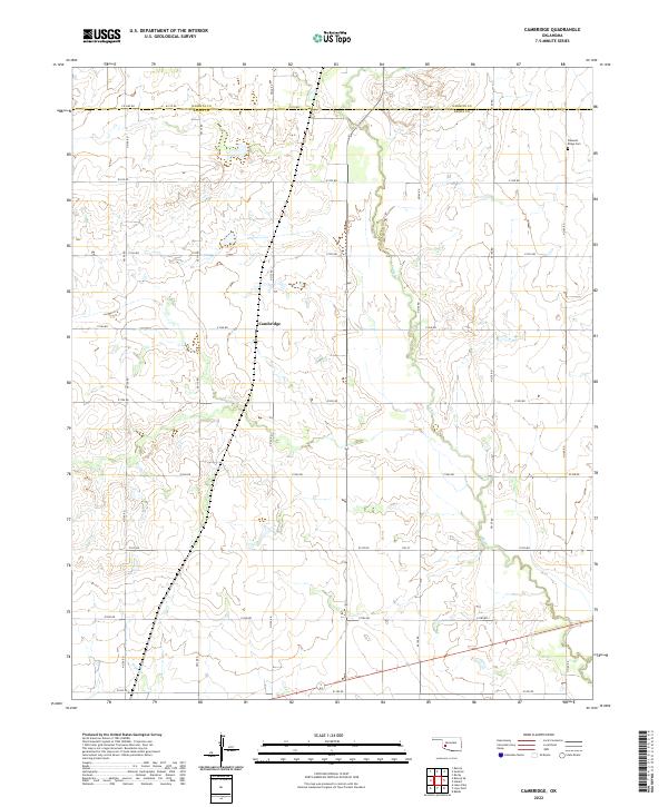
2022 Map of Cambridge
USGS Topo · Published 2022About this map
The quiet rural landscape surrounding Cambridge is defined by the winding course of Elk Cr, which carves through the undulating plains of the Oklahoma southwest. This 2022 survey documents the section lines and road networks that partition the agricultural heartland at the intersection of Kiowa and Washita counties. The community of Cambridge serves as a central point in this sparsely populated region, where the grid-like road system facilitates movement across the open prairie. Modern topographical data reveals the drainage patterns and subtle elevation changes that have historically shaped land use and ranching in this portion of the Great Plains.
Find a feature on this map
2 named features on this map. Tap any name to fly to it.
Don’t see what you’re looking for? This feature index may not catch every label — zoom into the map to look around manually.
Map Details
Editions of this 2022 Cambridge Map
This is the sole edition of this map. No revisions or reprints were ever made.
Other maps of this area

1955 · Lawton
USGS Topo · 1:250,000

1955 · Clinton
USGS Topo · 1:250,000

1957 · Clinton
USGS Topo · 1:250,000

1961 · Hobart
USGS Topo · 1:62,500

1961 · Retrop
USGS Topo · 1:62,500

1963 · Babbs
USGS Topo · 1:24,000

1964 · Lone Wolf
USGS Topo · 1:24,000

1971 · Lake Altus
USGS Topo · 1:24,000

1984 · Sentinel
USGS Topo · 1:24,000
1984 · Hobart
USGS Topo · 1:24,000