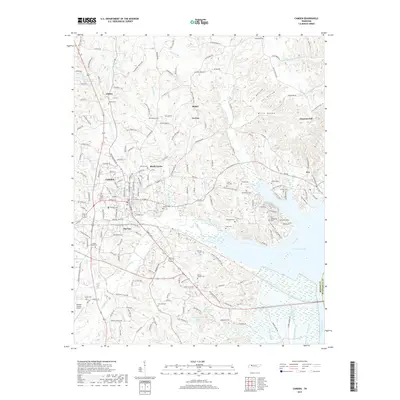
2019 Map of Camden
USGS Topo · Published 2019About this map
Camden serves as the central hub of this West Tennessee landscape, where the CSX Transportation line and several major roadways converge. The area's history is deeply etched into the terrain through a high density of small family and community burial grounds, including Hudson Cem, Lashlee Cem, and the Old Bethlehem Cem near the shores of Kentucky Lake. The map reveals a pattern of dispersed rural settlements like Black Center, Pea Ridge, and Tin Cup, which reflect the region's agricultural and timber-based heritage. To the east, the inundation of the Tennessee River valley is evident, with fingers of the lake reaching into drainages like Cypress Creek and Hawley Creek. This geography created a distinctive shoreline that reshaped local access and industry, while inland features like the Benton County Airport represent more modern infrastructure developments.
Find a feature on this map
199 named features on this map. Tap any name to fly to it.
Don’t see what you’re looking for? This feature index may not catch every label — zoom into the map to look around manually.
Map Details
Editions of this 2019 Camden Map
This is the sole edition of this map. No revisions or reprints were ever made.
Other maps of this area

1936 · Camden
USGS Topo · 1:24,000

1936 · Seventeen Creek
USGS Topo · 1:24,000

1936 · Big Sandy
USGS Topo · 1:24,000

1936 · Johnsonville
USGS Topo · 1:24,000

1936 · Bruceton
USGS Topo · 1:24,000

1936 · Harmon Creek
USGS Topo · 1:24,000

1936 · Rockport
USGS Topo · 1:24,000

1936 · Manleyville
USGS Topo · 1:24,000

1936 · Hustburg
USGS Topo · 1:24,000

1940 · Manleyville
USGS Topo · 1:24,000