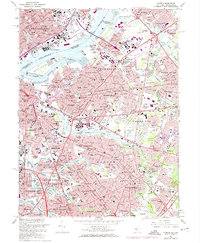
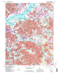
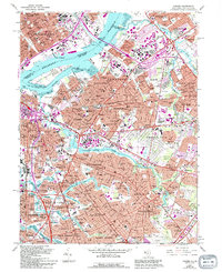
1967 Map of Camden
USGS Topo · Published 1974About this map
The industrial and residential expansion of Camden and its neighbors in the mid-1960s is preserved here, as suburban growth began to densify around the core urban centers. Extensive rail networks like the Penn Central, Reading, and Pennsylvania lines define the landscape, connecting the Delaware River waterfront and Petty Island to the surrounding communities. The transition from industrial corridors to meticulously planned green spaces is evident in the layout of Cooper River Parkway and the sprawling grounds of Harleigh Cemetery.
Find a feature on this map
207 named features on this map. Tap any name to fly to it.
Don’t see what you’re looking for? This feature index may not catch every label — zoom into the map to look around manually.
Map Details
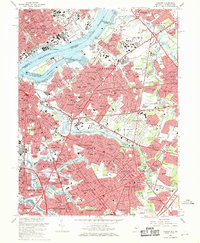
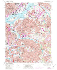
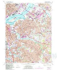
Editions of this 1967 Camden Map
6 editions found
Other maps of this area

1888 · Mount Holly
USGS Topo · 1:62,500

1890 · Burlington
USGS Topo · 1:62,500

1891 · Philadelphia
USGS Topo · 1:62,500

1893 · Germantown
USGS Topo · 1:62,500

1893 · Burlington
USGS Topo · 1:62,500

1894 · Mount Holly
USGS Topo · 1:62,500

1894 · Philadelphia
USGS Topo · 1:62,500

1894 · Germantown
USGS Topo · 1:62,500

1896 · Germantown
USGS Topo · 1:62,500

1896 · Philadelphia
USGS Topo · 1:62,500