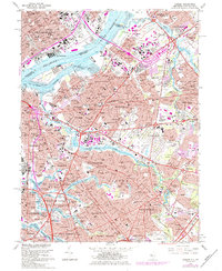
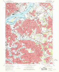
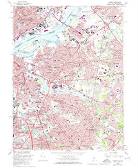
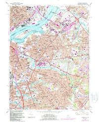
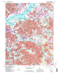
1967 Map of Camden
USGS Topo · Published 1984About this map
Petty Island and the Back Channel anchor this detailed study of the industrial and residential corridors connecting New Jersey to Pennsylvania. The Delaware River serves as the central artery, crossed by the Benjamin Franklin Bridge and the Walt Whitman Bridge, which facilitated the mid-century expansion of Camden and its surrounding boroughs. The map highlights a dense network of suburban development in places like Cherry Hill and Haddonfield, punctuated by expansive green spaces such as Garden State Park and the grounds of Calvary Cemetery.
Find a feature on this map
194 named features on this map. Tap any name to fly to it.
Don’t see what you’re looking for? This feature index may not catch every label — zoom into the map to look around manually.
Map Details
Editions of this 1967 Camden Map
6 editions found
Other maps of this area

1888 · Mount Holly
USGS Topo · 1:62,500

1890 · Burlington
USGS Topo · 1:62,500

1891 · Philadelphia
USGS Topo · 1:62,500

1893 · Germantown
USGS Topo · 1:62,500

1893 · Burlington
USGS Topo · 1:62,500

1894 · Mount Holly
USGS Topo · 1:62,500

1894 · Philadelphia
USGS Topo · 1:62,500

1894 · Germantown
USGS Topo · 1:62,500

1896 · Germantown
USGS Topo · 1:62,500

1896 · Philadelphia
USGS Topo · 1:62,500