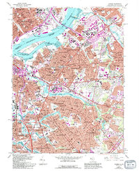
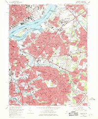
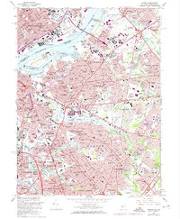
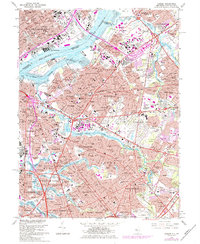
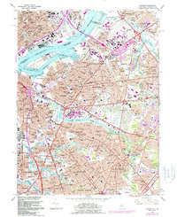
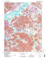
1967 Map of Camden
USGS Topo · Published 1994About this map
The Delaware River separates the dense urban grids of Philadelphia and Camden, creating a landscape defined by heavy industry, shipping, and a complex network of mid-century infrastructure. This survey captures the region as suburban expansion surged into Pennsauken and Maple Shade, contrasting with the established residential neighborhoods of Collingswood and Haddon. Significant transit routes like the Benjamin Franklin Bridge and the Walt Whitman Bridge anchor the riverfront, while the New Jersey Turnpike and Atlantic City Expressway signal the era's shift toward high-speed automobile travel.
Find a feature on this map
153 named features on this map. Tap any name to fly to it.
Don’t see what you’re looking for? This feature index may not catch every label — zoom into the map to look around manually.
Map Details
Editions of this 1967 Camden Map
6 editions found
Other maps of this area

1888 · Mount Holly
USGS Topo · 1:62,500

1890 · Burlington
USGS Topo · 1:62,500

1891 · Philadelphia
USGS Topo · 1:62,500

1893 · Germantown
USGS Topo · 1:62,500

1893 · Burlington
USGS Topo · 1:62,500

1894 · Mount Holly
USGS Topo · 1:62,500

1894 · Philadelphia
USGS Topo · 1:62,500

1894 · Germantown
USGS Topo · 1:62,500

1896 · Germantown
USGS Topo · 1:62,500

1896 · Philadelphia
USGS Topo · 1:62,500