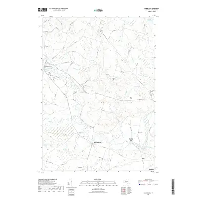
2019 Map of Camden East
USGS Topo · Published 2019About this map
Camden and the surrounding hamlets of McConnellsville and Blossvale are defined by the winding course of West Branch Fish Creek as it moves through the heart of Oneida County. This modern survey illustrates the persistent settlement patterns of central New York, where small communities like Dibbletown and Pine remain connected by a dense network of county roads such as Co Rd 70 and Co Rd 85. The landscape is a mix of low hills, including Corkin Hill and Pine Hill, and significant water resources like the Oneida City Reservoir and Faulkner Ponds.
Find a feature on this map
89 named features on this map. Tap any name to fly to it.
Don’t see what you’re looking for? This feature index may not catch every label — zoom into the map to look around manually.
Map Details
Editions of this 2019 Camden East Map
This is the sole edition of this map. No revisions or reprints were ever made.
Other maps of this area

1895 · Chittenango
USGS Topo · 1:62,500

1895 · Oneida
USGS Topo · 1:62,500

1898 · Oneida
USGS Topo · 1:62,500

1898 · Chittenango
USGS Topo · 1:62,500

1902 · Chittenango
USGS Topo · 1:62,500

1902 · Oneida
USGS Topo · 1:62,500

1905 · Taberg
USGS Topo · 1:62,500

1906 · Kasoag
USGS Topo · 1:62,500

1939 · Oneida
USGS Topo · 1:62,500

1941 · Jewell
USGS Topo · 1:24,000