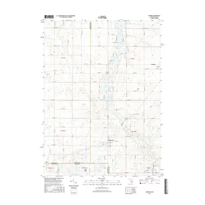
2017 Map of Camden
USGS Topo · Published 2017About this map
The tri-state corner where Michigan, Indiana, and Ohio converge is defined by a dense cluster of kettle lakes and agricultural settlements. Reading and Montgomery serve as primary hubs within this landscape, connected by a network of rural roads such as Kelley Rd and Rood Rd. The terrain is marked by significant wetlands, most notably the expanse of Big Swamp and the headwaters of the W Fork W Br Saint Joseph River, illustrating the post-glacial drainage patterns of the region.
Find a feature on this map
118 named features on this map. Tap any name to fly to it.
Don’t see what you’re looking for? This feature index may not catch every label — zoom into the map to look around manually.
Map Details
Editions of this 2017 Camden Map
This is the sole edition of this map. No revisions or reprints were ever made.
Other maps of this area

1914 · Pioneer
USGS Topo · 1:62,500

1939 · Angola East
USGS Topo · 1:24,000

1939 · Clear Lake
USGS Topo · 1:24,000

1940 · Clear Lake
USGS Topo · 1:24,000

1944 · Pioneer
USGS Topo · 1:62,500

1947 · Angola East
USGS Topo · 1:24,000

1953 · Fort Wayne
USGS Topo · 1:250,000

1956 · Fort Wayne
USGS Topo · 1:250,000

1959 · Hillsdale
USGS Topo · 1:24,000

1959 · Reading
USGS Topo · 1:24,000