
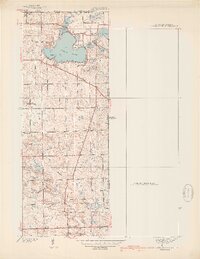
1939 Map of Clear Lake
USGS Topo · Published 1939About this map
Clear Lake dominates this 1938 survey of northeastern Indiana, where the borders of Ohio and Michigan meet. The map reveals a landscape of glacial lakes and marshy lowlands, including Mud Lake, Round Lake, and Lake Anne. These water bodies are surrounded by early developments like Paradise Pt and the Clear Lake Ch.
Find a feature on this map
34 named features on this map. Tap any name to fly to it.
Don’t see what you’re looking for? This feature index may not catch every label — zoom into the map to look around manually.
Map Details
Editions of this 1939 Clear Lake Map
2 editions found
Other maps of this area

1914 · Pioneer
USGS Topo · 1:62,500

1939 · Hamilton
USGS Topo · 1:24,000

1939 · Angola East
USGS Topo · 1:24,000

1940 · Metz
USGS Topo · 1:24,000

1940 · Clear Lake
USGS Topo · 1:24,000

1944 · Pioneer
USGS Topo · 1:62,500

1947 · Angola East
USGS Topo · 1:24,000

1948 · Hamilton
USGS Topo · 1:24,000

1953 · Fort Wayne
USGS Topo · 1:250,000

1956 · Fort Wayne
USGS Topo · 1:250,000