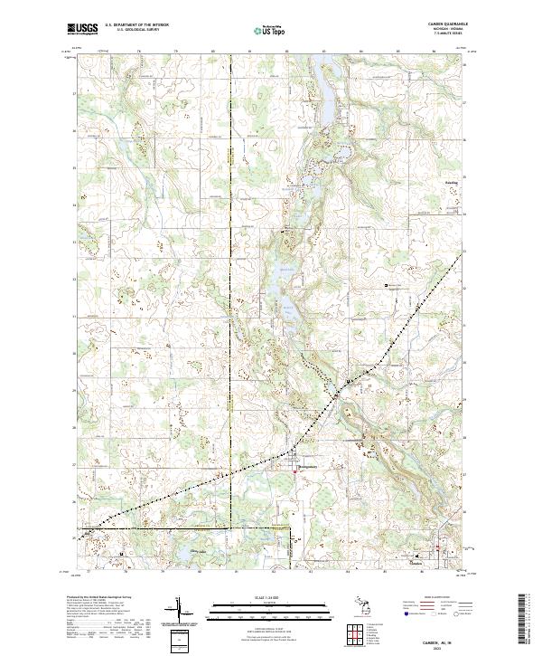
2023 Map of Camden
USGS Topo · Published 2023About this map
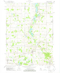
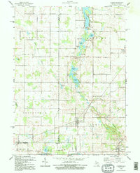
The tri-state corner of Michigan, Indiana, and Ohio defines this landscape, where Hillsdale and Branch counties meet Steuben County. The village of Camden sits near the southern edge of the sheet, while the larger settlement of Reading occupies the northeastern corner. This area is characterized by a high concentration of glacial kettle lakes and wetlands, including Suckey Lake, Mead Lake, and the expansive Big Swamp near the Indiana-Michigan border. These water bodies are connected by a network of drains and creeks, notably Fisher Creek and the West Fork West Branch Saint Joseph River.
Find a feature on this map
112 named features on this map. Tap any name to fly to it.
Don’t see what you’re looking for? This feature index may not catch every label — zoom into the map to look around manually.
Map Details
Editions of this 2023 Camden Map
This is the sole edition of this map. No revisions or reprints were ever made.
Historical Maps of Camden Through Time
3 maps found