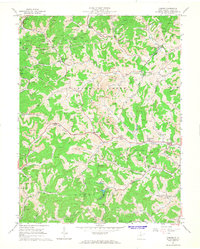
1964 Map of Camden
USGS Topo · Published 1965About this map
The rugged valleys and ridges of Lewis County in the mid-1960s are defined by a complex intersection of rural settlement and industrial extraction. Small communities like Churchville and Freemansburg anchor the northern reaches, while Camden serves as a central point along the winding course of Leading Creek. The landscape is heavily marked by the region's resource economy, with numerous Strip Mines and gas wells peppered across the hillsides, particularly surrounding Alum Fork and Freemans Creek.
Find a feature on this map
46 named features on this map. Tap any name to fly to it.
Don’t see what you’re looking for? This feature index may not catch every label — zoom into the map to look around manually.
Map Details
Editions of this 1964 Camden Map
2 editions found
Other maps of this area

1893 · Buckhannon
USGS Topo · 1:125,000

1893 · Sutton
USGS Topo · 1:125,000

1896 · Buckhannon
USGS Topo · 1:125,000

1897 · Buckhannon
USGS Topo · 1:125,000

1904 · Weston
USGS Topo · 1:62,500

1904 · Vadis
USGS Topo · 1:62,500

1906 · Burnsville
USGS Topo · 1:62,500

1912 · Crawford
USGS Topo · 1:48,000

1914 · Crawford
USGS Topo · 1:62,500

1925 · Burnsville
USGS Topo · 1:62,500