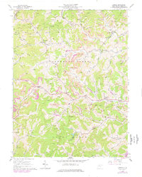
1964 Map of Camden
USGS Topo · Published 1977About this map
Freemans Creek and the surrounding Lewis County hills reveal a landscape heavily defined by the extraction of natural gas and coal during the mid-1960s. Scattered throughout the hollows are dozens of gas wells, linked by a network of pipelines and service roads that crisscross the terrain near Camden. Extensive Strip Mines are particularly concentrated along the ridges above Fink Creek and Left Fork, showing the industrial footprint of the era.
Find a feature on this map
54 named features on this map. Tap any name to fly to it.
Don’t see what you’re looking for? This feature index may not catch every label — zoom into the map to look around manually.
Map Details
Editions of this 1964 Camden Map
2 editions found
Other maps of this area

1893 · Buckhannon
USGS Topo · 1:125,000

1893 · Sutton
USGS Topo · 1:125,000

1896 · Buckhannon
USGS Topo · 1:125,000

1897 · Buckhannon
USGS Topo · 1:125,000

1904 · Weston
USGS Topo · 1:62,500

1904 · Vadis
USGS Topo · 1:62,500

1906 · Burnsville
USGS Topo · 1:62,500

1912 · Crawford
USGS Topo · 1:48,000

1914 · Crawford
USGS Topo · 1:62,500

1925 · Burnsville
USGS Topo · 1:62,500