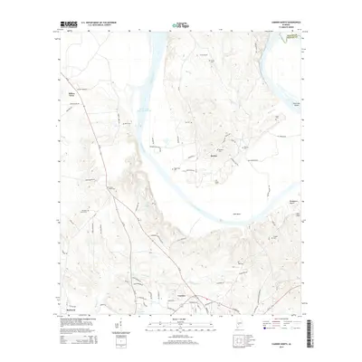
2014 Map of Camden North
USGS Topo · Published 2014About this map
The Alabama River carves a sweeping arc through the heart of Wilcox County, defining the distinctive landscape of Gees Bend. This area, deeply connected to African American history and cultural traditions, is dotted with numerous small family and community burial grounds, including Sandhill Cem, Pettway Cem, and Sodom Cem. To the north, the river broadens into the William 'Bill' Dannelly Reservoir near the settlement of Millers Ferry. The map captures a primarily rural environment where agricultural patterns are shaped by the winding water and numerous small tributaries like Shell Creek and Foster Cr. Settlement centers such as Boykin and the northern edge of Camden provide local anchors, while historical markers like Old Saint Francis Cem and Canton Bend Cem offer valuable points of reference for genealogists and local historians tracing family lineages in this river-bottom region.
Find a feature on this map
82 named features on this map. Tap any name to fly to it.
Don’t see what you’re looking for? This feature index may not catch every label — zoom into the map to look around manually.
Map Details
Editions of this 2014 Camden North Map
This is the sole edition of this map. No revisions or reprints were ever made.
Other maps of this area

1953 · Montgomery
USGS Topo · 1:250,000

1953 · Andalusia
USGS Topo · 1:250,000

1956 · Montgomery
USGS Topo · 1:250,000

1957 · Montgomery
USGS Topo · 1:250,000

1957 · Andalusia
USGS Topo · 1:250,000

1957 · Carlowville
USGS Topo · 1:62,500

1973 · Coy
USGS Topo · 1:24,000

1973 · Camden South
USGS Topo · 1:24,000

1974 · Crumptonia
USGS Topo · 1:24,000

1974 · Catherine
USGS Topo · 1:24,000