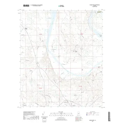
2018 Map of Camden North
USGS Topo · Published 2018About this map
Gees Bend and the surrounding river bottomlands define this portion of Wilcox County, where the Alabama River winds through a landscape of historic family settlements and cemeteries. The modern geography is dominated by the William 'Bill' Dannelly Reservoir, which borders the community of Millers Ferry and creates the expansive Ellis Island. This survey illustrates the intricate relationship between the river's path and local genealogy, documenting numerous small burial grounds such as Becks Cem, Irby Cem, and Pigeonfield Cem.
Find a feature on this map
75 named features on this map. Tap any name to fly to it.
Don’t see what you’re looking for? This feature index may not catch every label — zoom into the map to look around manually.
Map Details
Editions of this 2018 Camden North Map
This is the sole edition of this map. No revisions or reprints were ever made.
Other maps of this area

1953 · Montgomery
USGS Topo · 1:250,000

1953 · Andalusia
USGS Topo · 1:250,000

1956 · Montgomery
USGS Topo · 1:250,000

1957 · Montgomery
USGS Topo · 1:250,000

1957 · Andalusia
USGS Topo · 1:250,000

1957 · Carlowville
USGS Topo · 1:62,500

1973 · Coy
USGS Topo · 1:24,000

1973 · Camden South
USGS Topo · 1:24,000

1974 · Crumptonia
USGS Topo · 1:24,000

1974 · Catherine
USGS Topo · 1:24,000